Due to many factors like climate change, the ever growing need for clean water, and changes in waterways, the size of bodies of water across the world have experienced changes. Ocean levels have risen, but some lakes and seas have experienced a decrease in size. One in particular is the Aral sea. The Aral sea is a major water source for Uzbekistan, but has experienced a massive decrease in total water content. The cause of this is the diversion of waterways upstream in Kazakhstan and Russia. The images below depict the massive change in the size of the Aral Sea.
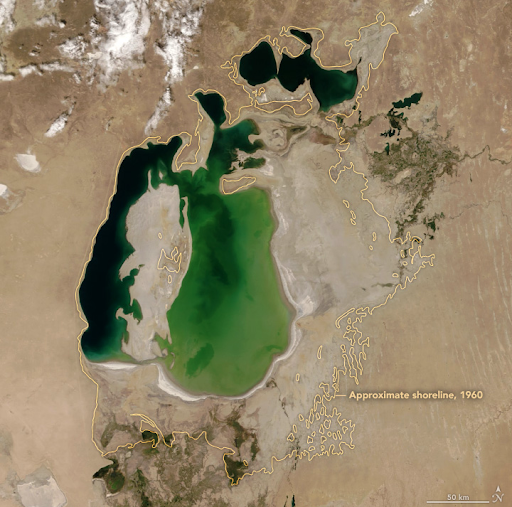
Aral sea in 2000
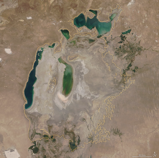
Aral sea in 2018
This is an unimaginable loss of a natural resource for those that live in that area. This huge change in the size of the Aral sea has been inspiration to look into how my local lakes are doing. What kind of changes have they been experiencing over time?
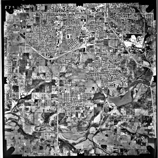
There are three main lakes around Springfield: Fellows Lake, McDaniels Lake, and Lake Springfield. They each offer different qualities that benefit the surrounding community. All of them are a source of recreation in the form of fishing or hiking, and Fellows Lake and McDaniels lake provide 52% of the drinking water in Springfield (EPA). To get a wide range of time to test, aerial photos of the lakes from 1990 and imagery from 2022 will be compared. This gives a time span of 32 years to see how the levels have changed. The photos from 1990 were retrieved from Greene County Missouri 1990 Aerial Photograph Interactive Index Map on arcgis.com.
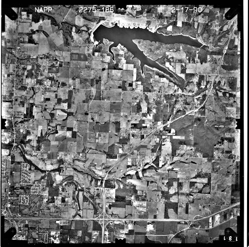
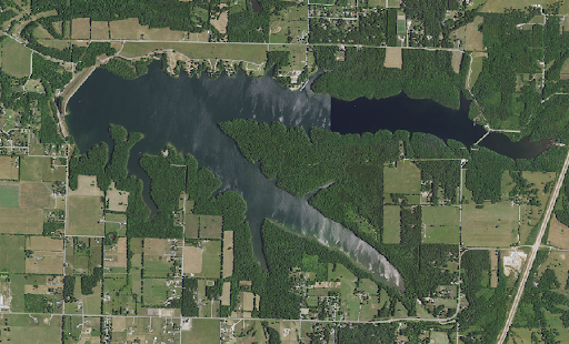
Fellows Lake in 1990
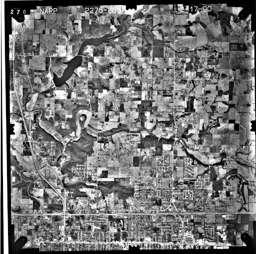
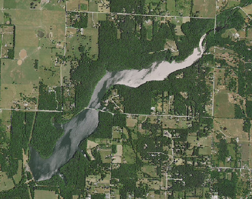
McDaniels Lake in 1990
Lake Springfield in 1990
The newer pictures to be compared to are from MSIDS NAIP 2022 Green County map
Fellows Lake in 2022
McDaniels Lake in 2022

Lake Springfield in 2022
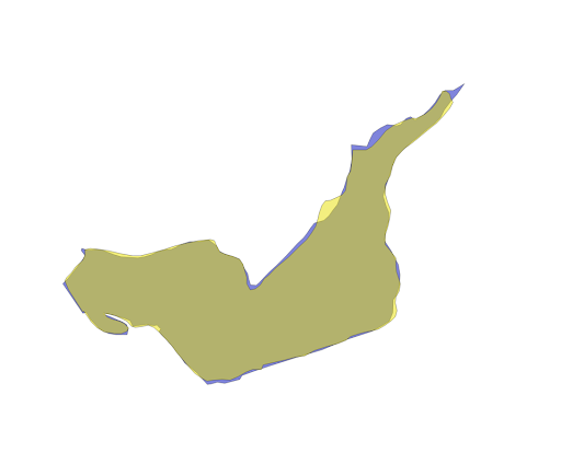
In order to compare the size of the lakes, a polygon must be drawn on the coast around each lake for each time period. The size of the polygon will determine the total amount of area the lakes cover and their shape will determine in what areas the lakes have gained or lost size. By overlaying each polygon on one another the visual difference will be clear.
The results: The overall size of the lakes experienced an increase over the 32 year span. First observed is Fellows lake since it is the largest of the three.

Fellows Lake Overlaid Polygons
The figure shown above is the two polygons for Fellows Lake from 1990 and 2022 overlaid. The yellow polygon represents 1990 and the blue represents 2022. Each is at 50% opacity to show which parts have changed. The 2022 polygon shows a general expansion in almost every part of the lake from where it was in 1990. The attribute table showed an increase from 2,669,825 square meters (660 acres) to 3,269,619 square meters (808 acres), which is an increase of 22%. Next to be observed is McDaniels Lake.

McDaniels Lake Overlaid Polygons
McDaniels lake also showed an increase in size since 1990. 864,390 square meters (214 acres) increased to 1,072,672 square meters (265 acres), which is an increase of 24%. Finally we will observe the change in Lake Springfield, which is the smallest of the three and experienced the least amount of change.
Lake Springfield Overlaid Polygons
Lake Springfield in the 32 year span increased from 773,634 square meters (191 acres) to 778,023 square meters (192 acres), which is an increase of less than 1%.
Some errors can be pointed out in this study, which must be factored in evaluating the results. The process of georeferencing in this case is not an exact measurement and carries the chance of human error in aligning landmarks. Some errors also arise from the photos from 1990 not being orthographic, which means that relief displacement could impact the perceived area. The resolution was also not very good, which can impact polygon creation.
Another possible aspect of this to be studied as well is depth of each of these lakes. The area across may have increased, but lakes are three dimensional objects that have a volume of water. If the area has increased but the depth has decreased, the size of the lake could be determined to not have increased.
The overall result that they had either stayed the same size or increased in size was surprising. The original expectation was that they would have all decreased in size, being that the inspiration for discussing this topic was the Aral sea. Some confidence can be in our knowledge around the management of the waterways surrounding Springfield.